Mapping whiz kids are tops in the state
Jana Peterson
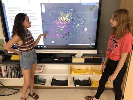
Cloquet students Marcy Ferrier, left, and Elizabeth Strickland, explain a map they created to show the effect of land cover and human disturbances affect the location of wolf dens and territories. The two girls took second place in a 2019 online mapping competition.
Using a relatively new geographical software known as ArcGIS, science fair students in Cloquet are taking their projects to new levels and winning awards.
Two teams of Cloquet High School students took first and second place in the 2019 Minnesota ArcGIS Online Mapping Competition for "story maps" they created as part of their science fair projects.
First place winners Payten Schneberger and MacKenzie Brummer examined the effect things like weather, industry and wind have on ozone levels in Duluth.
Their map/research was titled: What effect do local factors (lake breeze, industry, harbor and...
For access to this article please
sign in or
subscribe.